Ian Lindsay
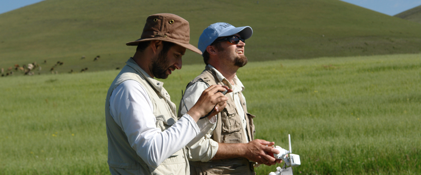
-- Ian Lindsay (right) together with Alan Greene (left), from Stanford, are utilizing drone technology to capture details and data from Bronze Age field sites in Armenia.
Ian Lindsay
When most people think of archaeology research, piloting drones isn't the first thing that comes to mind. But that's exactly what Ian Lindsay, a Purdue professor in anthropology, does for his work on ancient Armenia.
Photographing archaeological sites used to require kites and hot-air balloons, or expensive satellite images. For $1,500 per drone, Lindsay can capture the exact images and video he needs to plan excavations and provide data for other researchers. “Drones help offer a visual scope of what's already excavated, and what should be done next,” says Lindsay.
For Purdue students, Lindsay's research “gives a sense of actually being there at the site. It helps people understand the type of work we're doing in the field. And it’s more engaging than just looking at a map.”
The potential applications of drones in the field are wide open as well. Some researchers have started attaching sensors to create thermal maps of sites, and Lindsay says, “The sky really is the limit in this case.”